![](/images/other/stat-length.png)
![Tocht Stappen Welschnofen - Nova Levante - König Laurin Tour : Rosengarten et Karer See - Photo](https://media.geolcdn.com/t/1900/400/2ad6e741-6fec-4822-b31f-dfab06e808ef.jpg&format=pjpeg&maxdim=2)
König Laurin Tour : Rosengarten et Karer See
VacheKiri67
Gebruiker
![Lengte](/images/other/stat-length.png)
![Max. hoogte](https://static1.geolcdn.com/siteimages/upload/files/1508320355ic_sort_altitude_max_24dp.png)
![Positief hoogteverschil](https://static1.geolcdn.com/siteimages/upload/files/1508320355ic_sort_den_pos_24dp.png)
![Km-Effort](/images/other/stat-length.png)
![Min. hoogte](https://static1.geolcdn.com/siteimages/upload/files/1508320355ic_sort_altitude_min_24dp.png)
![Negatief hoogteverschil](https://static1.geolcdn.com/siteimages/upload/files/1508320355ic_sort_den_neg_24dp.png)
![Boucle](https://static1.geolcdn.com/siteimages/upload/files/16400158638029165_repeat_loop_refresh_sync_direction_icon.png)
![Stappen](https://static1.geolcdn.com/sitytour/trail-icons/101.png)
4h10
Moeilijkheid : Medium
![Scan deze QR-code om de tocht te openen in de SityTrail-applicatie](https://capi.geolives.com/qq0zvz2zws4bq2lad0pu/sitytour/trails/3744628/qr.png?size=200)
Gratisgps-wandelapplicatie
Over ons
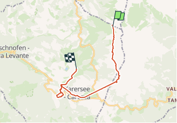
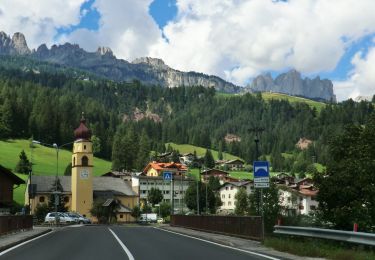
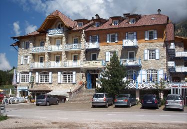
Tocht Stappen van 11,3 km beschikbaar op Trento-Zuid-Tirol, Bolzano - Bozen, Welschnofen - Nova Levante. Deze tocht wordt voorgesteld door VacheKiri67.
Beschrijving
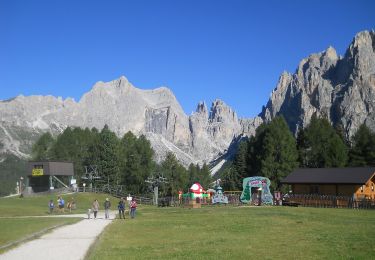
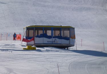
Faite le 23/07/2023. Montée en télécabine depuis Welschnofen. Nécessite le ticket à la journée "Rosengarten Pass" pour emprunter les 7 trajets en télécabines et télésièges du parcours.
Ce parcours demande cependant "d'avoir le pied sûr" et de ne pas être sensible au vertige à certains endroits.
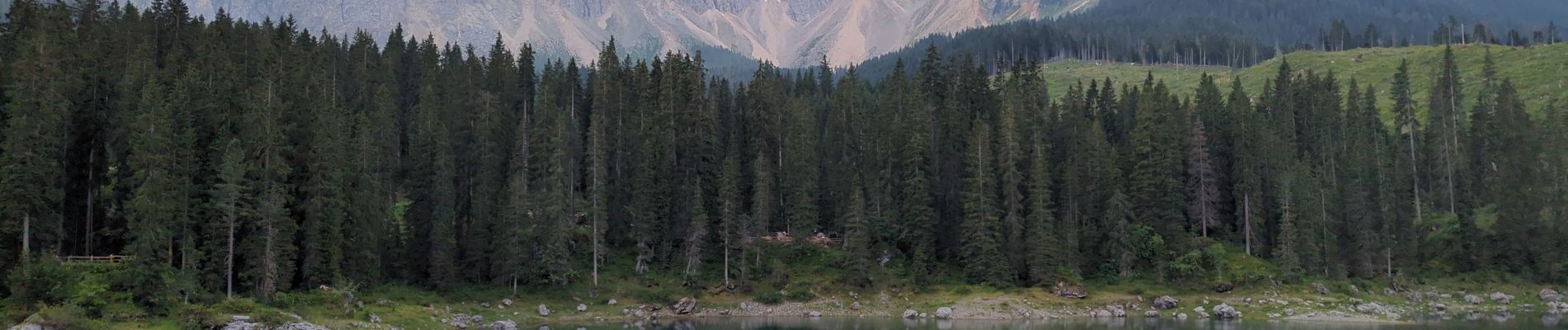
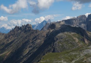
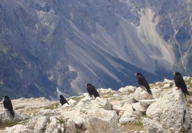
Randonnée magnifique pour découvrir le Rosengarten et le Karer See. Le sentier d'approche vers la Paolinahütte est particulièrement beau.
Plaatsbepaling
Opmerkingen
Wandeltochten in de omgeving
![Tocht Te voet Tiers - Tires - (SI C17N) San Cipriano Tires - Rifugio Bolzano - Photo](https://media.geolcdn.com/t/375/260/4fc38a9b-b08c-4877-83af-70e6a972a0c8.jpeg&format=jpg&maxdim=2)
![Te voet Te voet](https://static1.geolcdn.com/sitytour/trail-icons/100.png)
Te voet
![](/images/other/stat-length.png)
![](https://static1.geolcdn.com/siteimages/upload/files/16400158638029165_repeat_loop_refresh_sync_direction_icon.png)
![Tocht Te voet Welschnofen - Nova Levante - (SI C16N) Bivio Rifugio Coronelle - San Cipriano Tires - Photo](https://media.geolcdn.com/t/375/260/11658389-d649-45f4-beaf-2028cacd09ab.jpeg&format=jpg&maxdim=2)
![Te voet Te voet](https://static1.geolcdn.com/sitytour/trail-icons/100.png)
Te voet
![](/images/other/stat-length.png)
![](https://static1.geolcdn.com/siteimages/upload/files/16400158638029165_repeat_loop_refresh_sync_direction_icon.png)
![Tocht Te voet Tiers - Tires - (SI C17N OLD) San Cipriano Tires - Rifugio Bolzano - Photo](https://media.geolcdn.com/t/375/260/4fc38a9b-b08c-4877-83af-70e6a972a0c8.jpeg&format=jpg&maxdim=2)
![Te voet Te voet](https://static1.geolcdn.com/sitytour/trail-icons/100.png)
Te voet
![](/images/other/stat-length.png)
![](https://static1.geolcdn.com/siteimages/upload/files/16400158638029165_repeat_loop_refresh_sync_direction_icon.png)
![Tocht Te voet San Giovanni di Fassa - Vial de la Feide - Photo](https://media.geolcdn.com/t/375/260/6e70268f-2c34-4740-ba65-7f0bb6d0da4c.jpeg&format=jpg&maxdim=2)
![Te voet Te voet](https://static1.geolcdn.com/sitytour/trail-icons/100.png)
Te voet
![](/images/other/stat-length.png)
![](https://static1.geolcdn.com/siteimages/upload/files/16400158638029165_repeat_loop_refresh_sync_direction_icon.png)
![Tocht Te voet Welschnofen - Nova Levante - N01 - Photo](https://media.geolcdn.com/t/375/260/4579c508-6219-4b3b-a050-86ec929436de.jpeg&format=jpg&maxdim=2)
![Te voet Te voet](https://static1.geolcdn.com/sitytour/trail-icons/100.png)
Te voet
![](/images/other/stat-length.png)
![](https://static1.geolcdn.com/siteimages/upload/files/16400158638029165_repeat_loop_refresh_sync_direction_icon.png)
![Tocht Te voet San Giovanni di Fassa - Dolomiti 21 - Photo](https://media.geolcdn.com/t/375/260/b17ef325-971f-4ccb-af2c-a739665dd75f.jpeg&format=jpg&maxdim=2)
![Te voet Te voet](https://static1.geolcdn.com/sitytour/trail-icons/100.png)
Te voet
![](/images/other/stat-length.png)
![](https://static1.geolcdn.com/siteimages/upload/files/16400158638029165_repeat_loop_refresh_sync_direction_icon.png)
![Tocht Te voet Welschnofen - Nova Levante - IT-E552 - Photo](https://media.geolcdn.com/t/375/260/7083cf5a-1e2d-4127-befe-ff264928c50d.jpeg&format=jpg&maxdim=2)
![Te voet Te voet](https://static1.geolcdn.com/sitytour/trail-icons/100.png)
Te voet
![](/images/other/stat-length.png)
![](https://static1.geolcdn.com/siteimages/upload/files/16400158638029165_repeat_loop_refresh_sync_direction_icon.png)
![Tocht Te voet Soraga di Fassa - IT-E556 - Photo](https://media.geolcdn.com/t/375/260/3701ddd4-9512-4797-bf94-4285951a9be7.jpeg&format=jpg&maxdim=2)
![Te voet Te voet](https://static1.geolcdn.com/sitytour/trail-icons/100.png)
Te voet
![](/images/other/stat-length.png)
![](https://static1.geolcdn.com/siteimages/upload/files/16400158638029165_repeat_loop_refresh_sync_direction_icon.png)
![Tocht Te voet San Giovanni di Fassa - IT-E517 - Photo](https://media.geolcdn.com/t/375/260/1071793f-19f6-441d-ad8e-1250d709fe5f.jpeg&format=jpg&maxdim=2)
![Te voet Te voet](https://static1.geolcdn.com/sitytour/trail-icons/100.png)
Te voet
![](/images/other/stat-length.png)
![](https://static1.geolcdn.com/siteimages/upload/files/16400158638029165_repeat_loop_refresh_sync_direction_icon.png)